While firefighters work to extinguish the Los Angeles-area wildfires, city officials and emergency managers are also worried about what could come next.
The potential for rain the weekend of Jan. 25-26 could help tamp down the fires. But rain can also trigger dangerous floods and debris flows on burned hillslopes.
These flows can move with the speed of a freight train, picking up or destroying anything in their path, and move tons of sediment during a single storm, as Montecito, just up the coast from L.A., saw in 2018.
What causes these debris flows, sometimes called mudflows, and why are they so common and dangerous after a fire? I am a geologist whose research focuses on pyrogeomorphology, which is how fire affects the land. Here’s what we know.
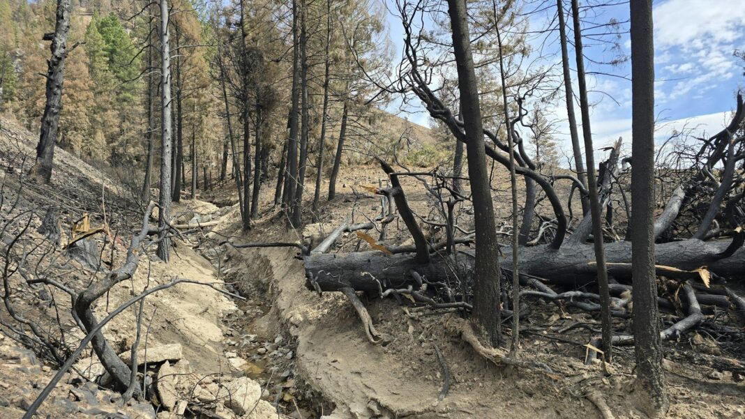
When severe fires burn hillslopes, the high heat from the fires, sometimes exceeding 1,000 degrees Fahrenheit (538 degrees Celsius), completely destroys trees, shrubs, grass and structures, leaving behind a moonscape of gray ash. Not only that, the heat of the fire actually burns and damages the soil, creating a water-repellent, or hydrophobic, layer.
What once was a vegetated hillslope, with leaves and trees to intercept rain and spongy soils to absorb water, is transformed into a barren landscape covered with ash, and burned soil where water cannot soak in.
When rain does fall on this burned area, water mixes with the ash, rocks and sediment to form a slurry. This slurry of debris then pours downhill in small gullies called rills, which then converge to form bigger and bigger rills, creating a torrent of sediment, water and debris rushing downhill. All this debris and water can transform small streams and usually dry gullies into a danger zone.
Because the concentration of sediment is so high, especially when there is a large amount of ash and clay, debris flows behave more like a slurry of wet cement than a normal stream. This fluid can pick up and move large boulders, cars, trees and other debris rapidly downhill.
In January 2018, a few weeks after the Thomas fire burned through the hills above Montecito, a storm triggered debris flows that killed 23 people and damaged at least 400 homes.
The geography of the land, burn severity, storm intensity and soil characteristics all play important roles in if, when and where debris flows occur.
Fire and debris flow scientists with the U.S. Geological Survey use these variables to create models to predict the likelihood and possible hazards from postfire debris flows. They are already developing maps to help residents, emergency managers and city officials prepare and predict postfire debris flows in 2025 burn areas in Los Angeles.
Some of the triggers of debris flows are literally part of the landscape.
For example, the slope angle in a watershed and the amount of clay in the soil are important. Watersheds with gentle slopes – generally less than about 23 degrees – and a lack of clay and silt-sized particles are unlikely to produce debris flows.
Other key factors that contribute to postfire debris flows relate to the proportion of the watershed that is severely burned and the intensity and duration of the rainstorm event.
Early important research in the field of pyrogeomorphology demonstrated that while large, intense storms are more likely to cause large, intense debris flows, even small rainstorms can produce debris flows in burned areas.
A whopping 21.8 million Americans live within 3 miles of where a fire burned during the past two decades, and that population more than doubled from 2000 to 2019. A recent study from central and northern California indicates that nearly all the observed increases in area burned by wildfires in recent decades are due to human-caused climate change.
The warming climate is also increasing the likelihood of more extreme downpours. The amount of moisture the atmosphere can hold increases by about 7% per degree Celsius of warming, leading to more intense downpours, particularly from ocean storms. In California, scientists project increases in rainfall intensity of 18% will result in an overall 110% increase in the probability of major debris flows.
Studies using models of fire, climate and erosion rates estimate that the amount of sediment flowing downhill after fires will increase by more than 10% in nine out of every 10 watersheds in the western U.S.
Even without rain, debris on fire-damaged slopes can be unstable. A small slide in Pacific Palisades shortly after a fire burned through the area split a home in two. A phenomenon called “dry ravel” is a dominant form of hillslope erosion following wildfires in chaparral environments in Southern California
Research on charcoal pieces from ancient debris flows has shown fires and erosion have shaped Earth’s landscape for at least thousands of years. However, the rising risk of wildfires near populated areas and the potential for increasingly intense downpours mean a greater risk of damaging and potentially deadly debris flows.
As their populations expand, community planners need to be aware of those risks and prepare.
This article is republished from The Conversation, a nonprofit, independent news organization bringing you facts and trustworthy analysis to help you make sense of our complex world. It was written by: Jen Pierce, Boise State University
Read more: How America courted increasingly destructive wildfires − and what that means for protecting homes today The West’s iconic forests are increasingly struggling to recover from wildfires – altering how fires burn could boost their chances Wildfire burn scars can intensify and even create thunderstorms that lead to catastrophic flooding – here’s how it works
Jen Pierce receives funding from the National Science Foundation and is the chair of the Quaternary Geology and Geomorphology division of the Geological Society of America. 


